Geographic Analysis focuses on areas where the crimes takes place. All the geographic analysis are performed using CartoDB and ArcGIS tool. To view more detailed information for understanding the more specific location. Please click on the below images and zoom in.
Crimes During The Day
The below map is created using CartoDB online tool. We can see the exact location of the crime and also during what time of the day it has occured, whether it’s morning, afternoon, evening or night. We can use filter to see either or any combination of day times and the crime location. This will help people to know the time and crime location so that they can take preventative actions. This would help police department to analyse duration and location of the crimes. They can be proactive and take preventive measure such as patrolling to avoid crime.
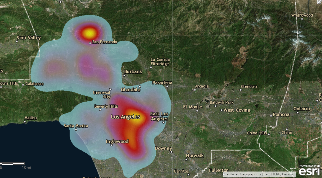
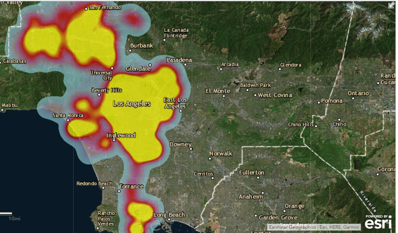
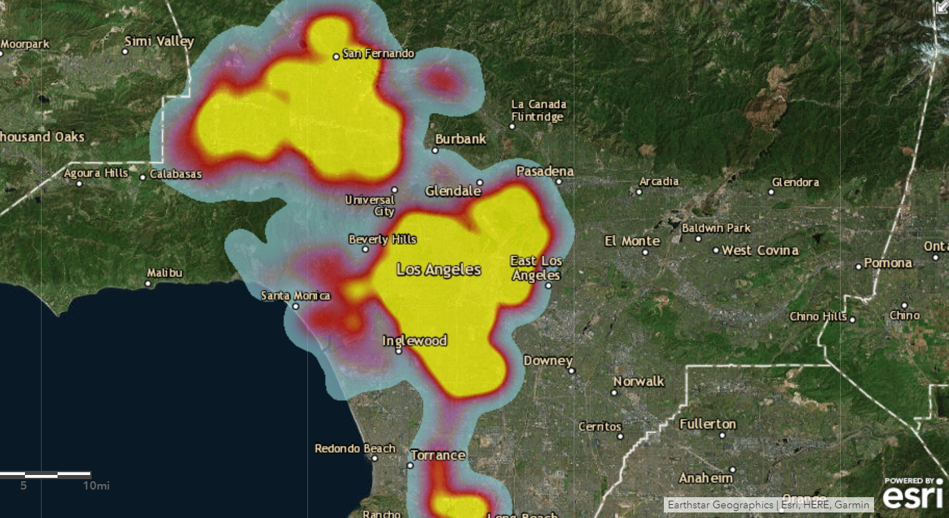
Crime Areas In Los Angeles.
The below is the heat map which shows where exactly in Los Angeles maximum number number of crimes occur. By this one will know which are the crime centric area in Los Angeles. If we zoom the map then we can that Chick Hearns, Wall Street, Hubbard crimes are more. With this map police depart can know the exact location where maximum crime has been occured and take preventative measure for the future to lower the crime rate in Los Angeles.
For our visualization, we have focused on top 4 crimes in Los Angeles and the area surrounding it.
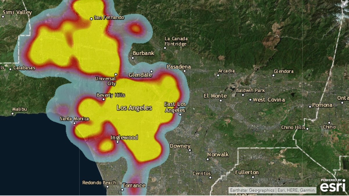
Battery Crime Areas In Los Angeles
The below heat map focuses on the area in Los Angeles that has maximum occurrence of Battery crime. As observed,Battery crime takes place in majority of the area. It is the highest occurring crime. If you click on the image and zoom in. You will observe the specific location eg : Hollywood, Mac Arthur Park etc. has maximum number of Battery Crimes. Hence the below heat map would help police to focus on the area and take preventative measure against Battery crimes.
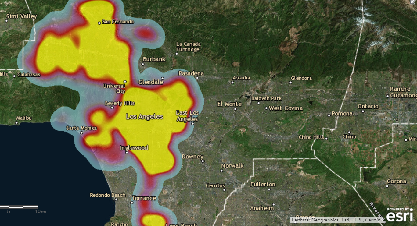
Domestic Assault Areas in Los Angeles
This map shows the area in Los Angeles where maximum number of Domestic assaults have occurred. If you click on the image and zoom in. You will observe the specific location eg : Hillcrest drive, Los Angeles downtown etc. has maximum number of Battery crimes. This will help police to know the area and take preventative measure as Domestic assault is the second highest occurring crime in Los Angeles.
Assault Crime Areas In Los Angeles.
This map shows the area in Los Angeles where maximum number of assaults are occured. For example areas such as Venice, Hollywood etc has maximum occurrence of Assault crime. This will help police to know the area and take preventative measure as assault is the third highest occurring crime in Los Angeles.
Child Abuse Crime Areas In Los Angeles
This map shows the area in Los Angeles where maximum number of Child abuse crimes are occured. For example,Hollywood, downtown etc are most dominant areas for Child abuse crime. This will help police to know the area and take preventative measure as Child abuse is one of the highest occurring crime in Los Angeles.
Conclusion
Thus, the above heat map would help the police department to reduce crimes by focusing on most dominant areas, the type of crime in the particular area and crimes in specific duration of the day. For example, Los Angeles downtown, Hollywood and Mac Arthur Road are most dominant crime areas. This would help them to be alert, well-informed, areas to focus and take preventive measure to reduce those crimes. For example, estimate the strength of police force and weapons required for the particular area by understanding the type and intensity of crime, need of patrolling and spread awareness among people.
